Vgrid DGGS Tools for QGIS
Vgrid DGGS Tools for QGIS
Vgrid Plugin requires the vgrid Python package to work properly. This means that before you can use the plugin, you must ensure that the vgrid package is installed in the Python environment that QGIS is using.
How you install vgrid depends on the type of QGIS installation you are using:
Open OSGeo4W Shell and run the following commands before (or after) installing Vgrid Plugin
python -m ensurepip
python -m pip install pip --upgrade
python -m pip install vgrid --upgrade
After installing Vgrid Plugin, a dialog will appear prompting you to install vgrid. Copy the following commands
import pip
pip.main(['install', 'vgrid','--upgrade'])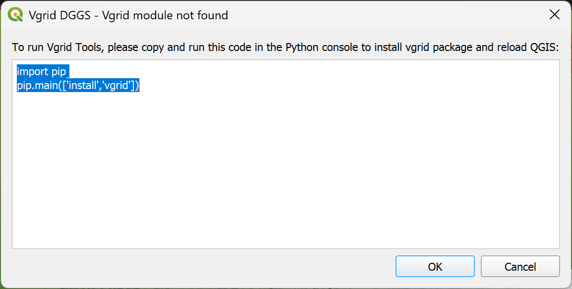
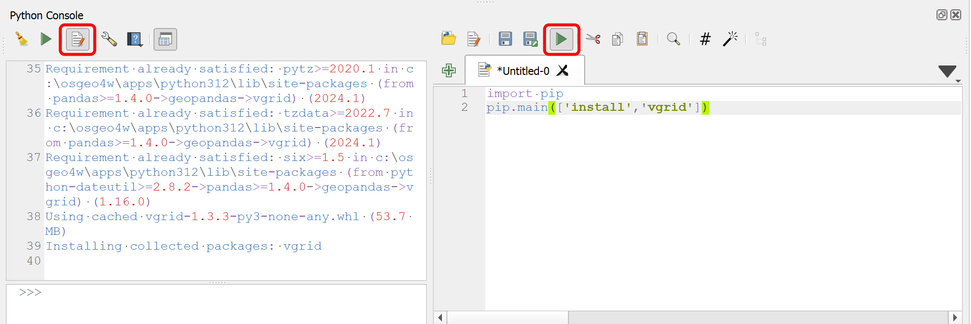
When QGIS starts, navigate to Plugins → Python Console, select Show Editor, paste the copied commands, and click Run Script.

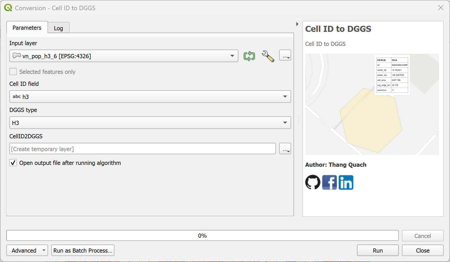
Convert DGGS Cell ID to DGGS.
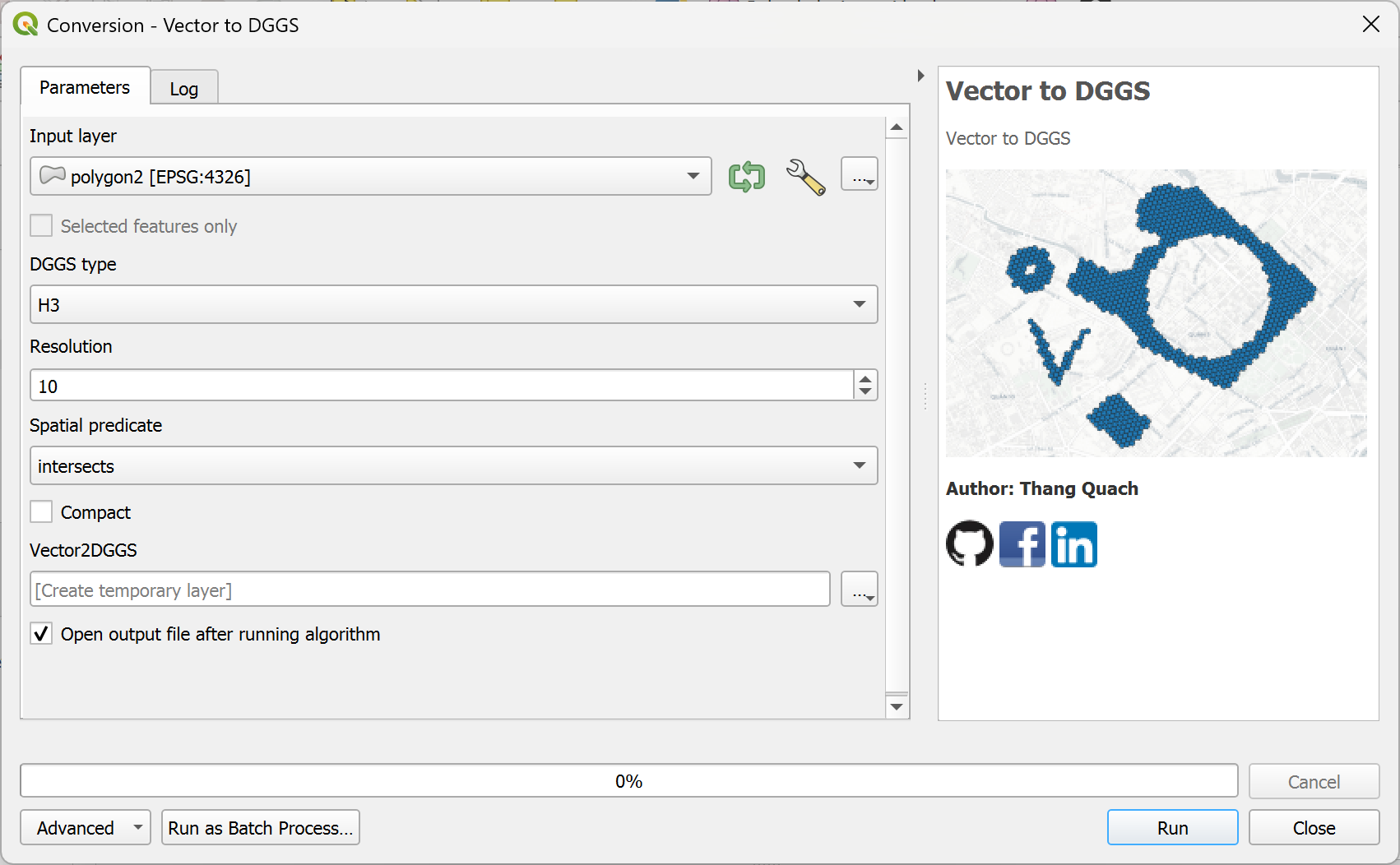
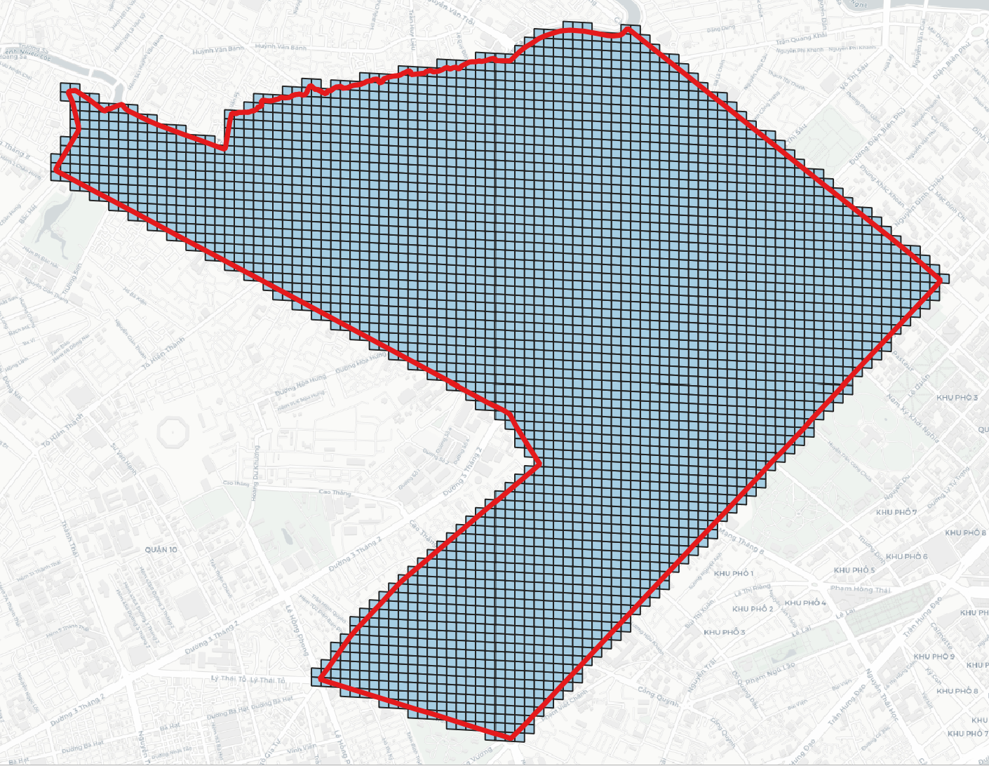
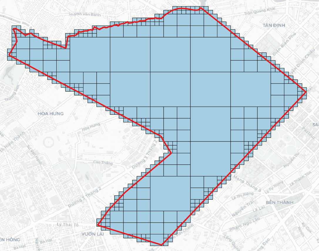
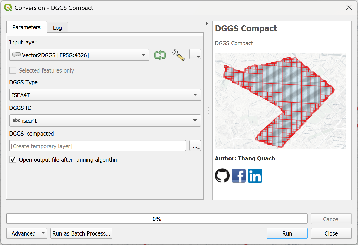
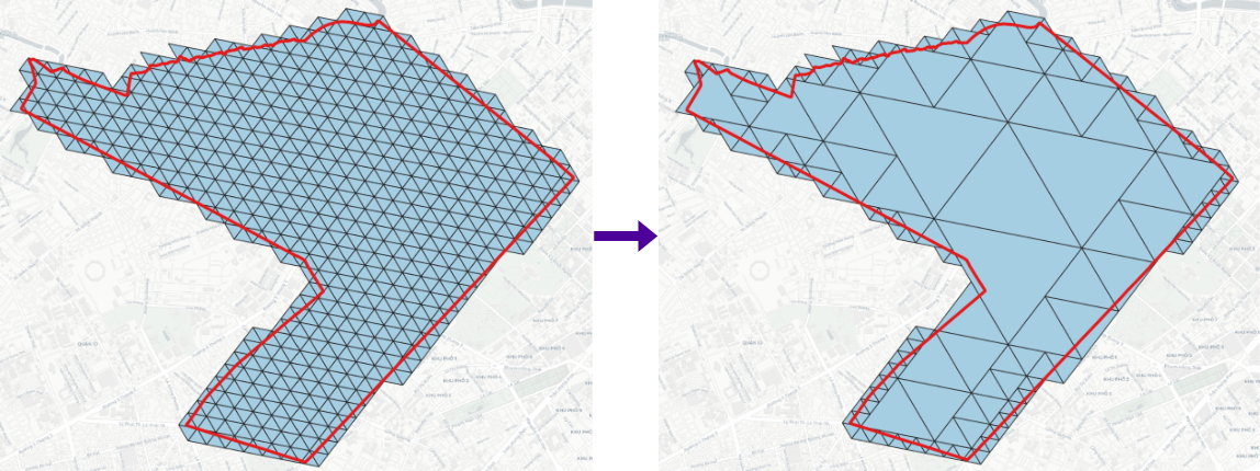
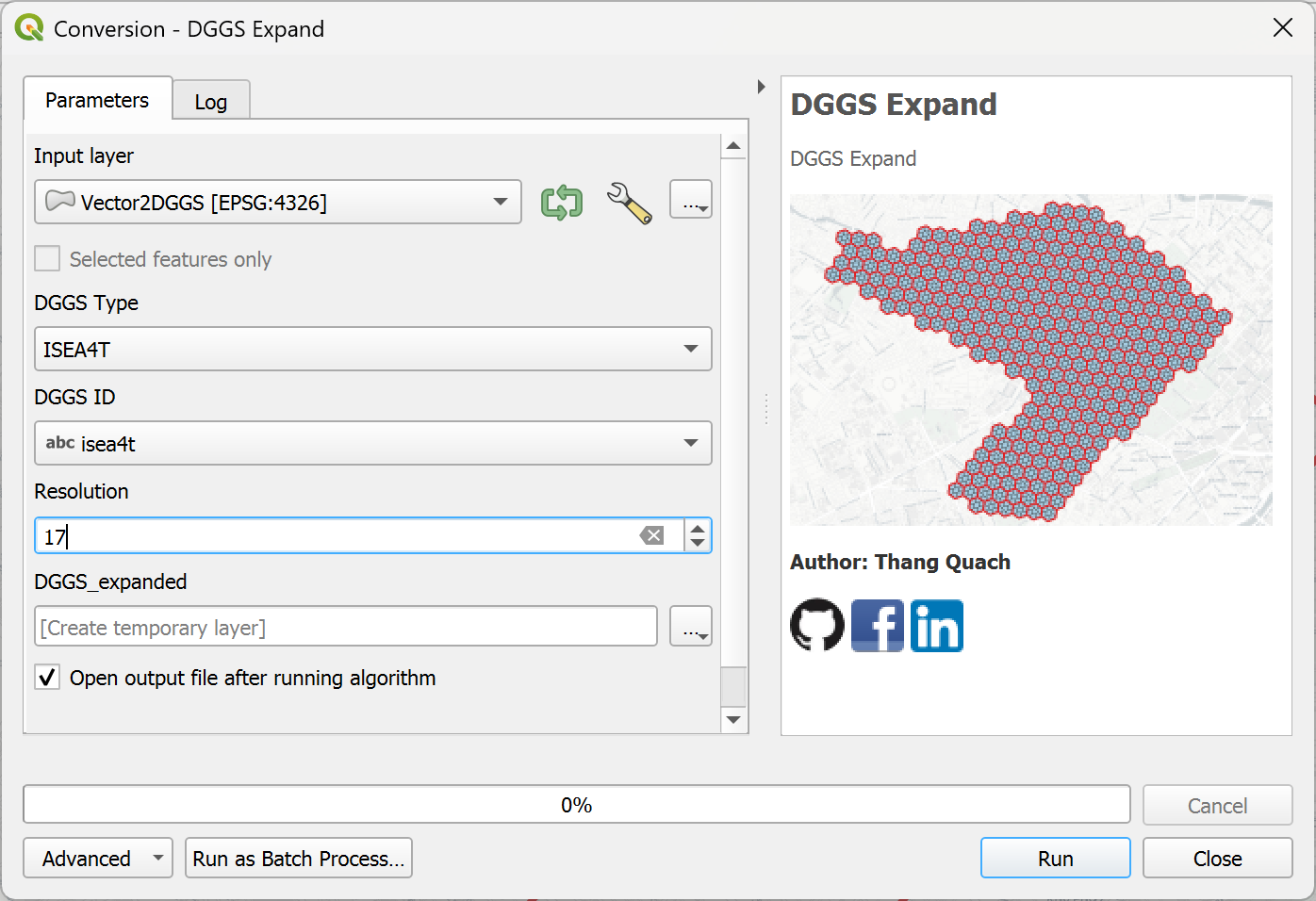
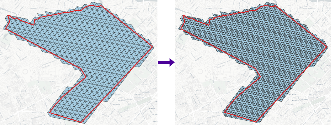
Convert Vector layers to DGGS.
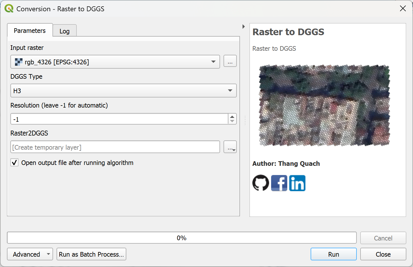
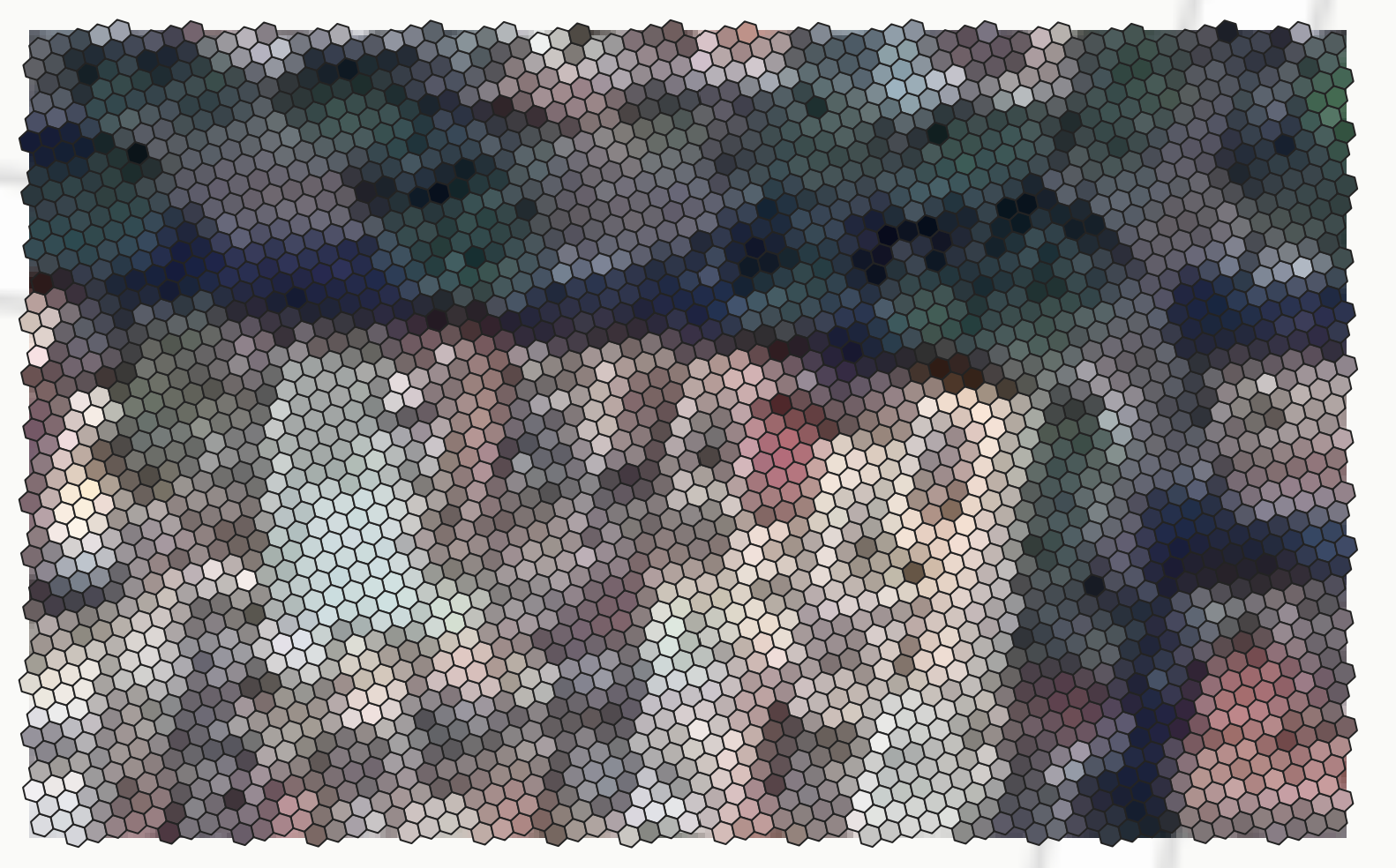
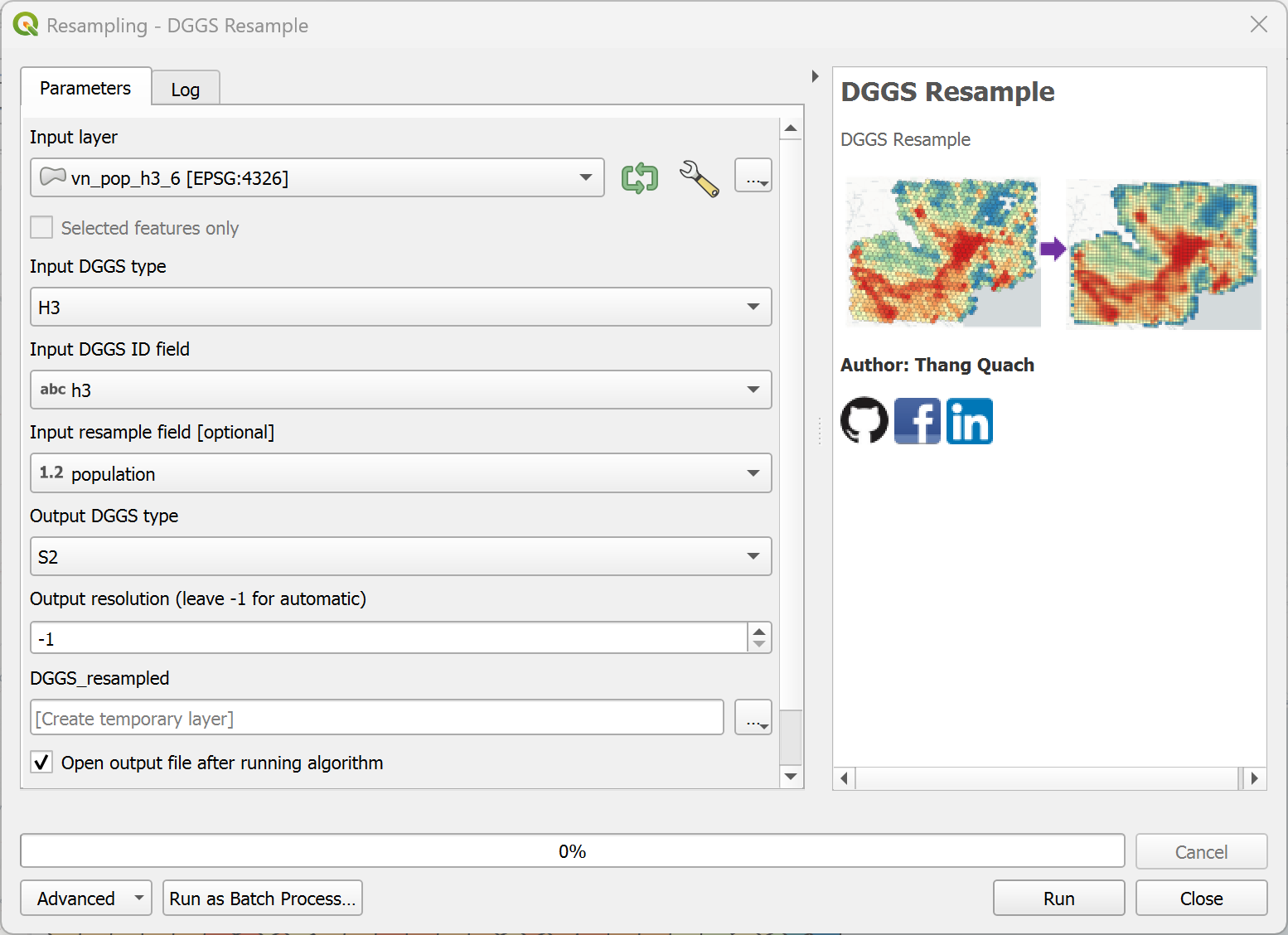
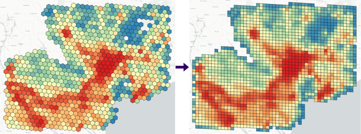
Convert raster layers in geographic CRS to DGGS.

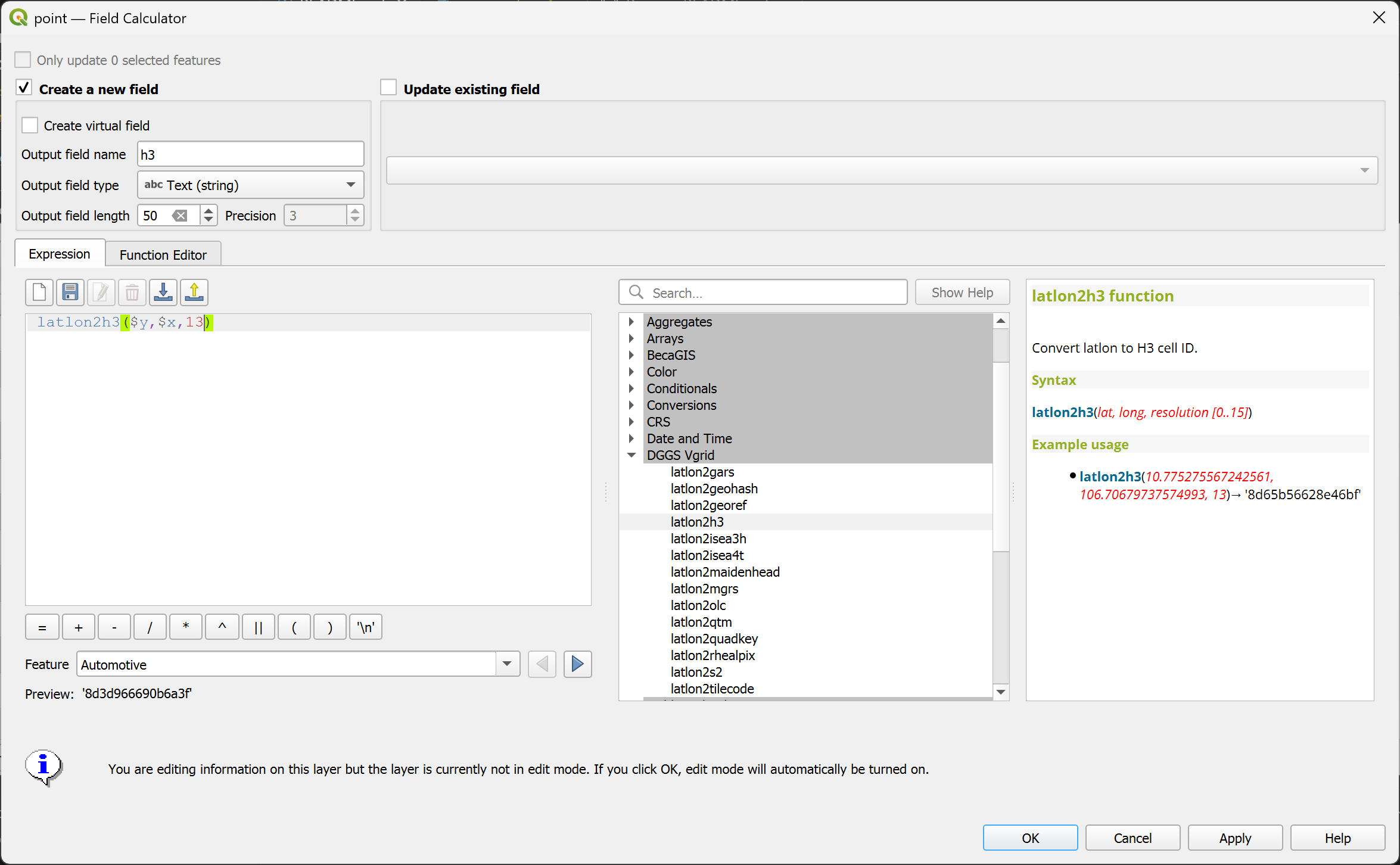
Convert (lat, long) to H3 ID.
latlon2h3(lat, long, resolution [0..15]) or latlon2h3($y, $x, resolution) in WGS84 CRS
latlon2h3(10.775275567242561, 106.70679737574993, 13)→ '8d65b56628e46bf'
Convert (lat, long) to S2 Token.
latlon2s2(lat, long, resolution [0-->30]) or latlon2s2($y, $x, resolution) in WGS84 CRS
latlon2s2(10.775275567242561, 106.70679737574993, 21)→ '31752f45cc94'

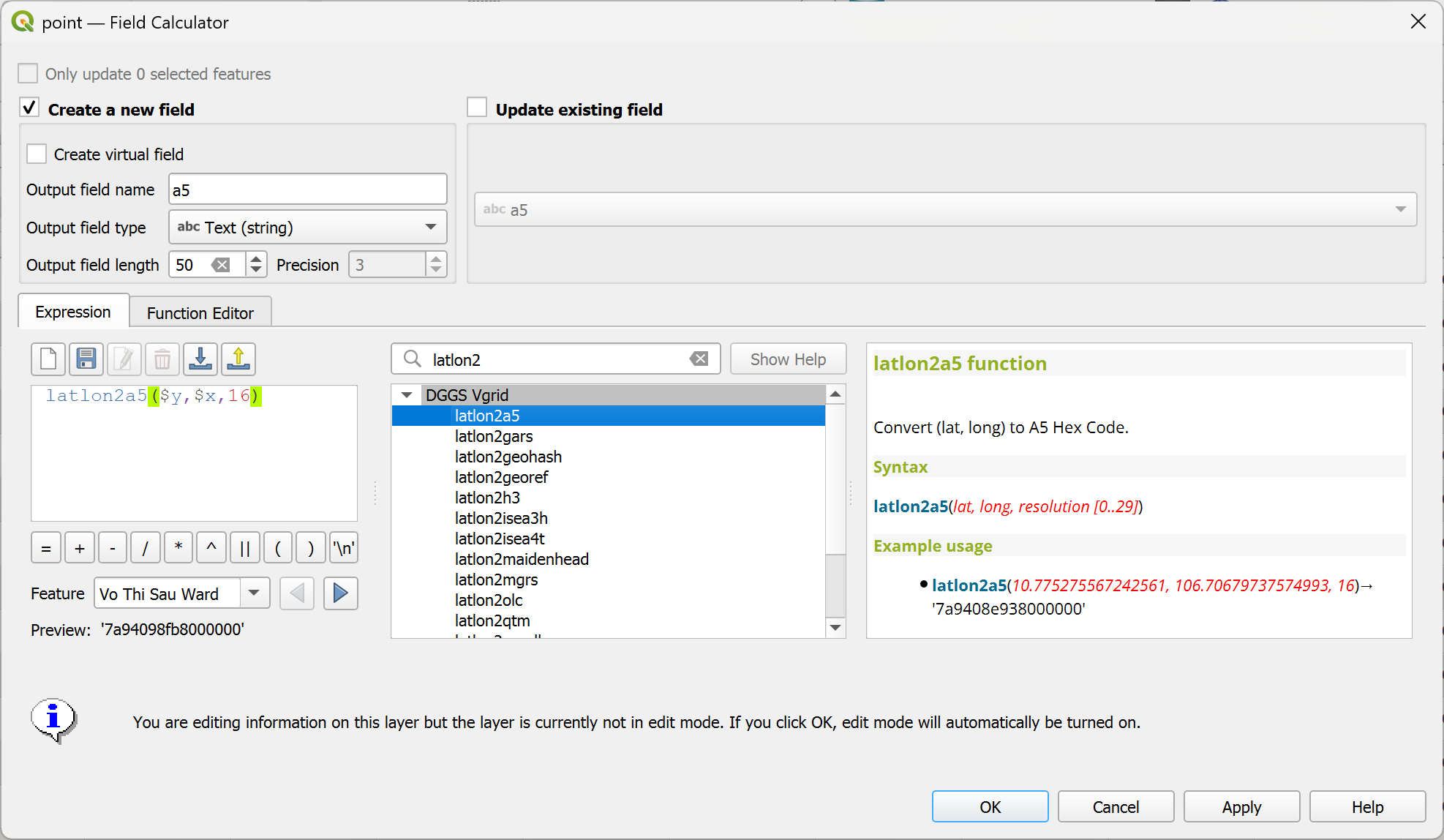
Convert (lat, long) to A5 Hex.
latlon2a5(lat, long, resolution [0-->29]) or latlon2a5($y, $x, resolution) in WGS84 CRS
latlon2a5(10.775275567242561, 106.70679737574993, 16)→ '7a9408e938000000'
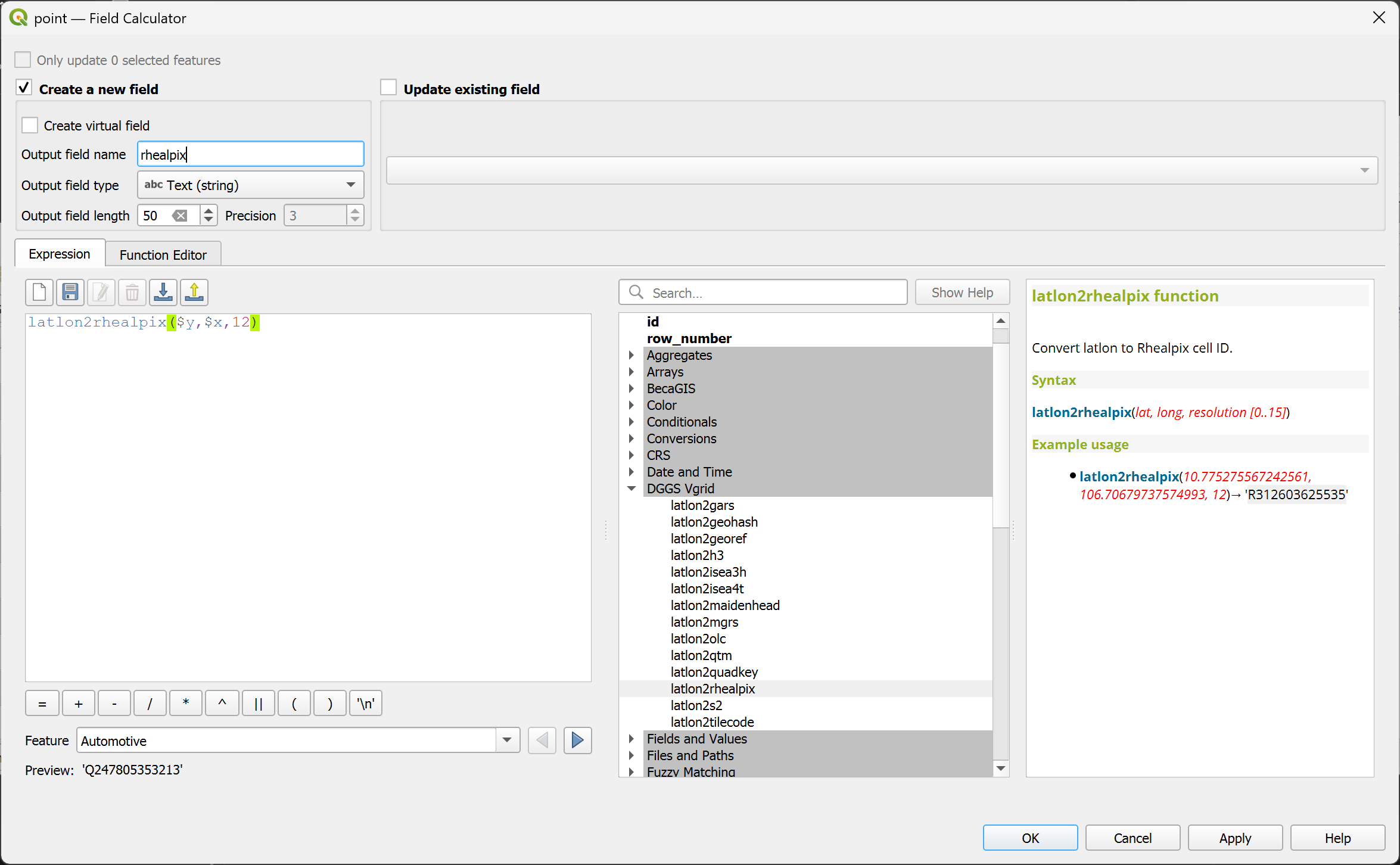
Convert (lat, long) to rHEALPix ID.
latlon2rhealpix(lat, long, resolution [0..15]) or latlon2rhealpix($y, $x, resolution) in WGS84 CRS
latlon2rhealpix(10.775275567242561, 106.70679737574993, 12)→ 'R312603625535'
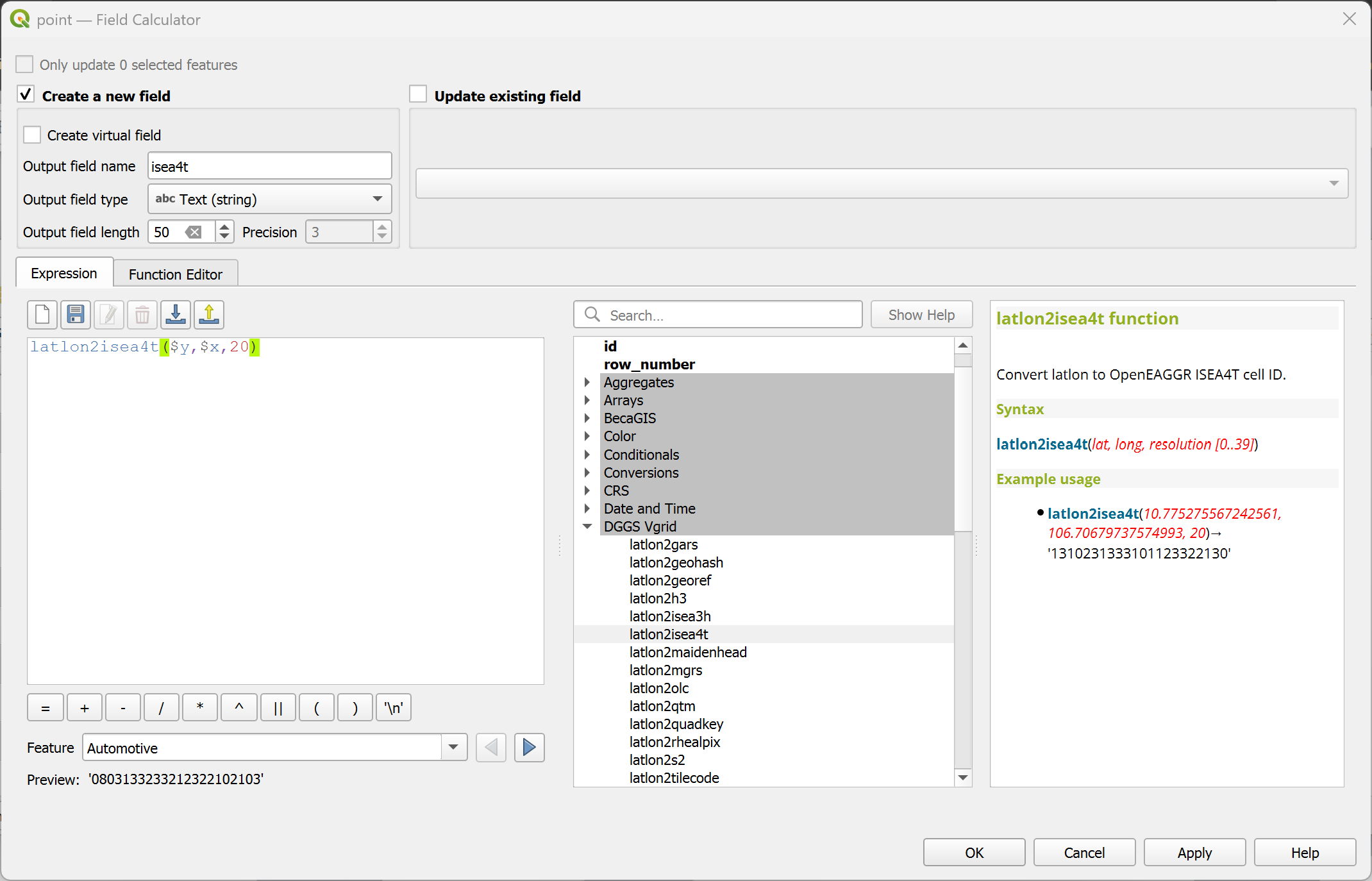
Convert (lat, long) to OpenEAGGR ISEA4T ID (Windows only).
latlon2isea4t(lat, long, resolution [0..39]) or latlon2isea4t($y, $x, resolution) in WGS84 CRS
latlon2isea4t(10.775275567242561, 106.70679737574993, 20)→ '1310231333101123322130'
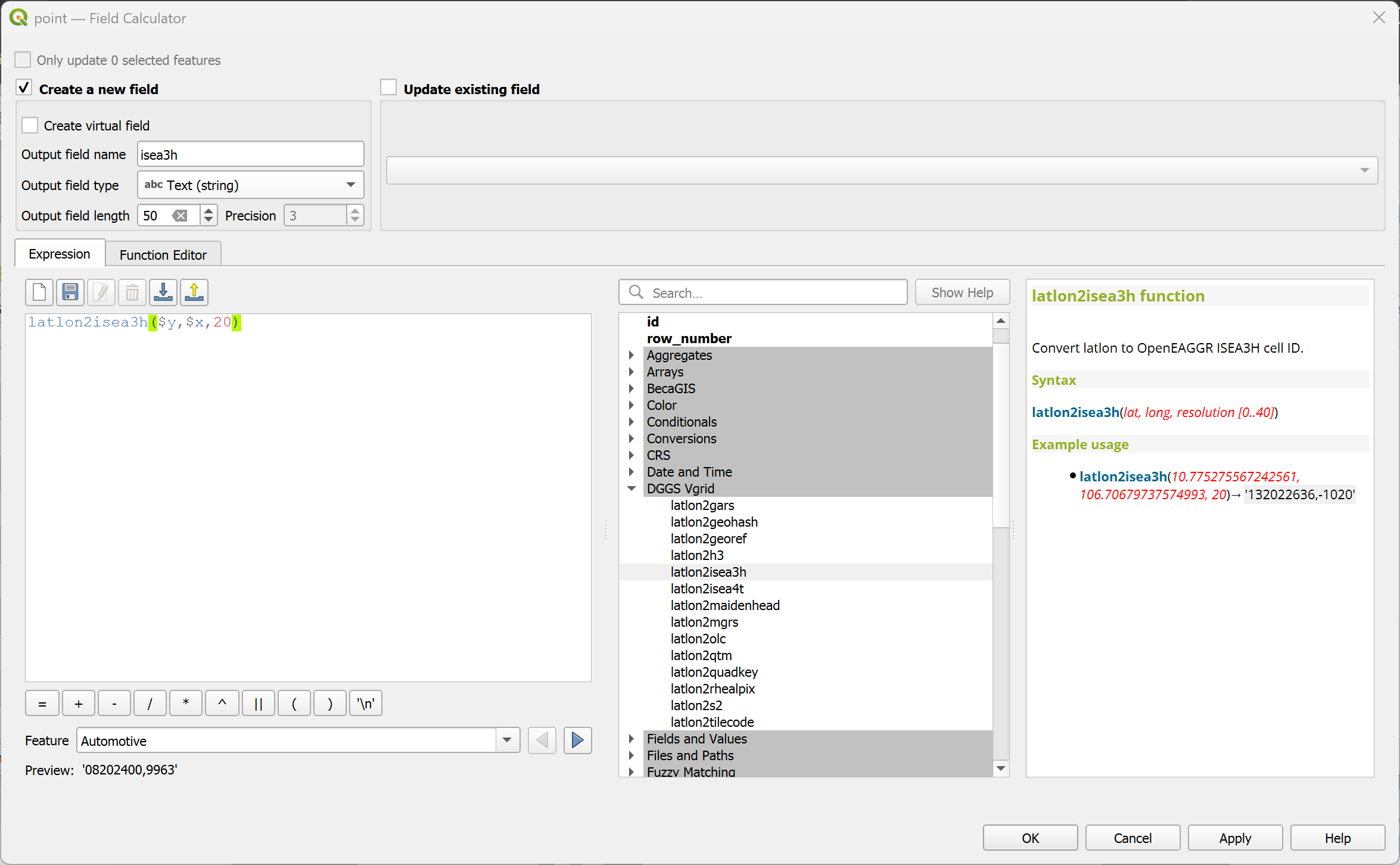
Convert (lat, long) to OpenEAGGR ISEA3H ID (Windows only).
latlon2isea3h(lat, long, resolution [0..40]) or latlon2isea3h($y, $x, resolution) in WGS84 CRS
latlon2isea3h(10.775275567242561, 106.70679737574993, 20)→ '132022636,-1020'
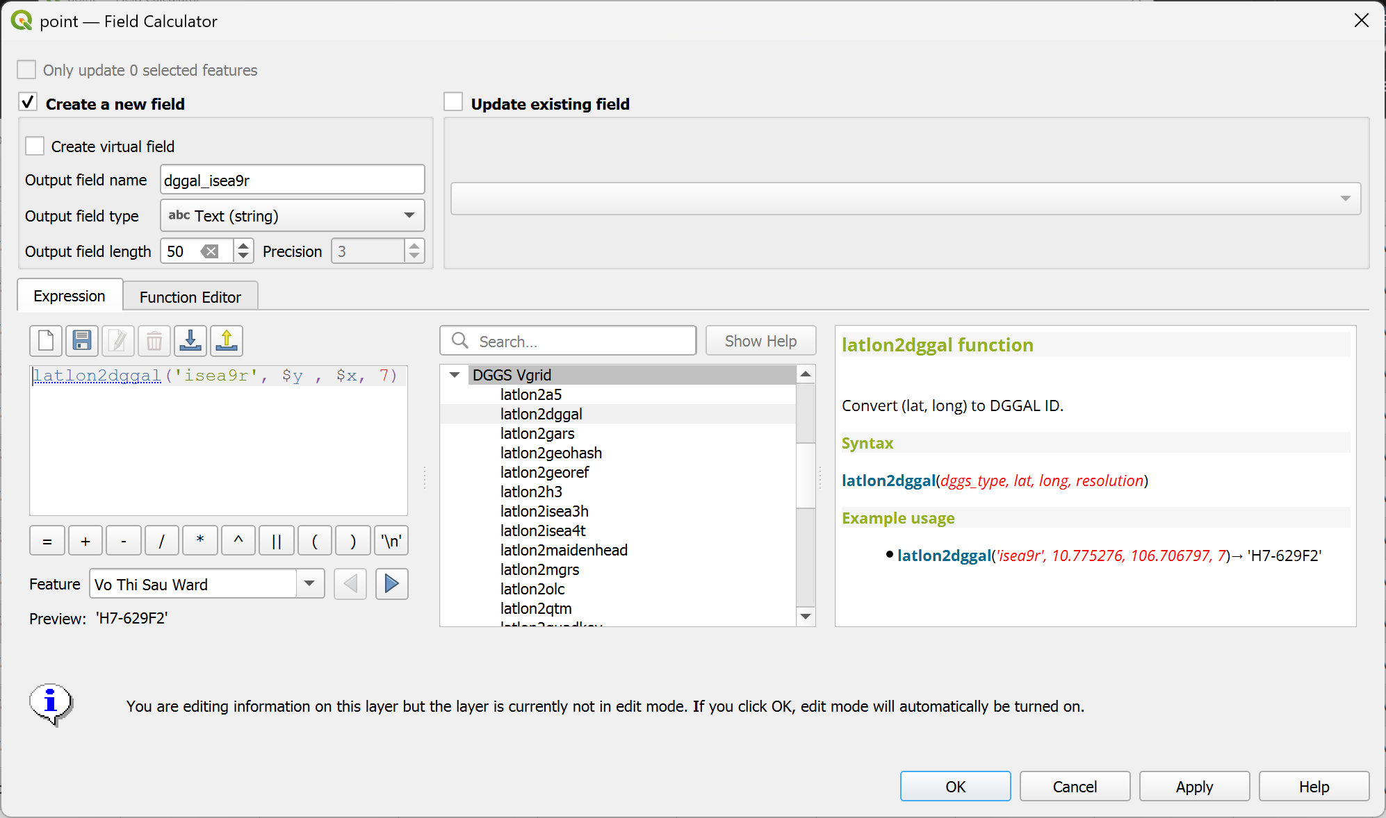
Convert (lat, long) to DGGAL ID.
latlon2dggal(dggs_type, lat, long, resolution) or latlon2dggal(dggs_type, $y, $x, resolution) in WGS84 CRS
latlon2dggal('isea9r', 10.775275567242561, 106.70679737574993, 7)→ 'H7-629F2'
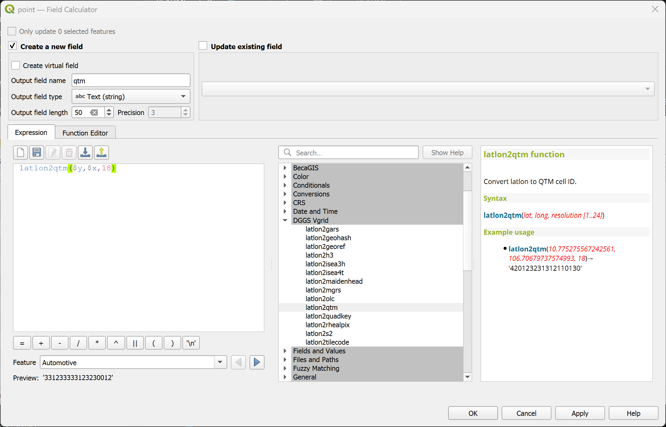
Convert (lat, long) to QTM.
latlon2qtm(lat, long, resolution [1..24]) or latlon2qtm($y, $x, resolution) in WGS84 CRS
latlon2qtm(10.775275567242561, 106.70679737574993, 18)→ '420123231312110130'
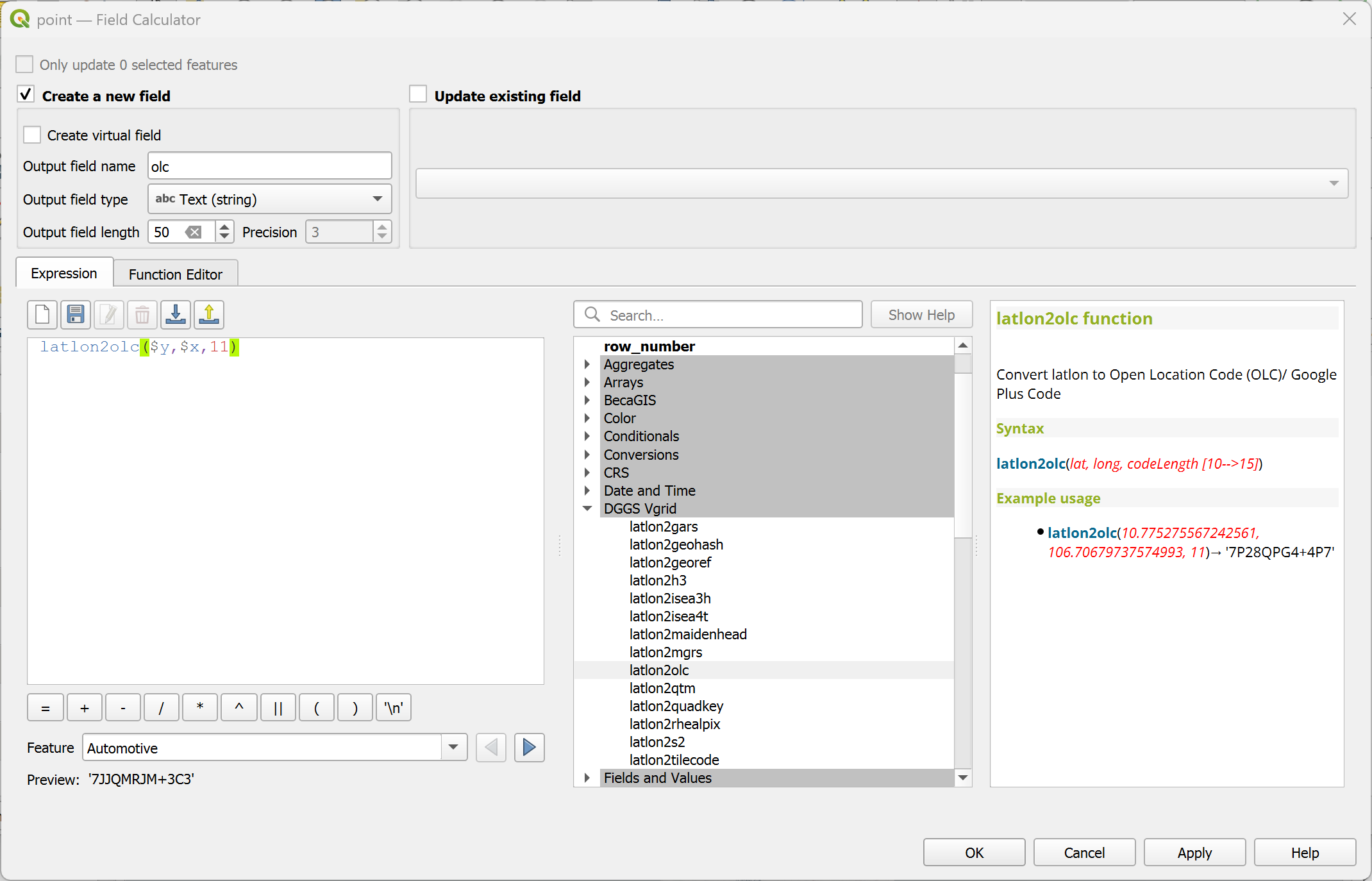
Convert (lat, long) to Open Location Code (OLC)/ Google Plus Code.
latlon2olc(lat, long, resolution [2,4,6,8,10,11..15]) or latlon2olc($y, $x, resolution) in WGS84 CRS
latlon2olc(10.775275567242561, 106.70679737574993, 11) → '7P28QPG4+4P7'
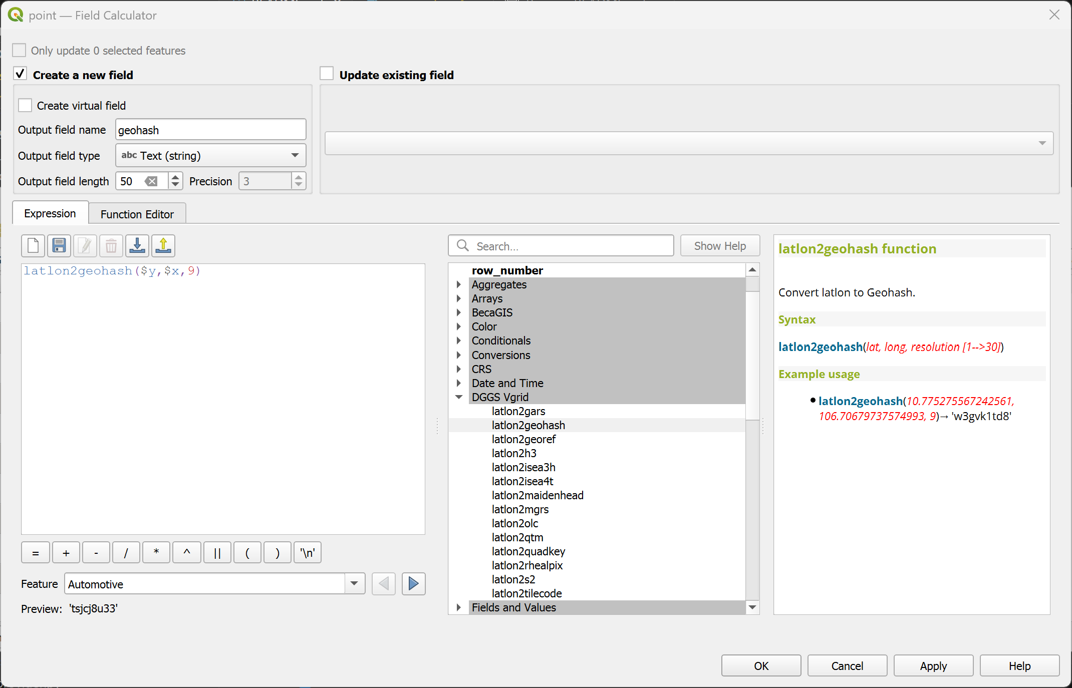
Convert (lat, long) to Geohash ID.
latlon2geohash(lat, long, resolution [1..30]) or latlon2geohash($y, $x, resolution) in WGS84 CRS
latlon2geohash(10.775275567242561, 106.70679737574993, 9)→ 'w3gvk1td8'
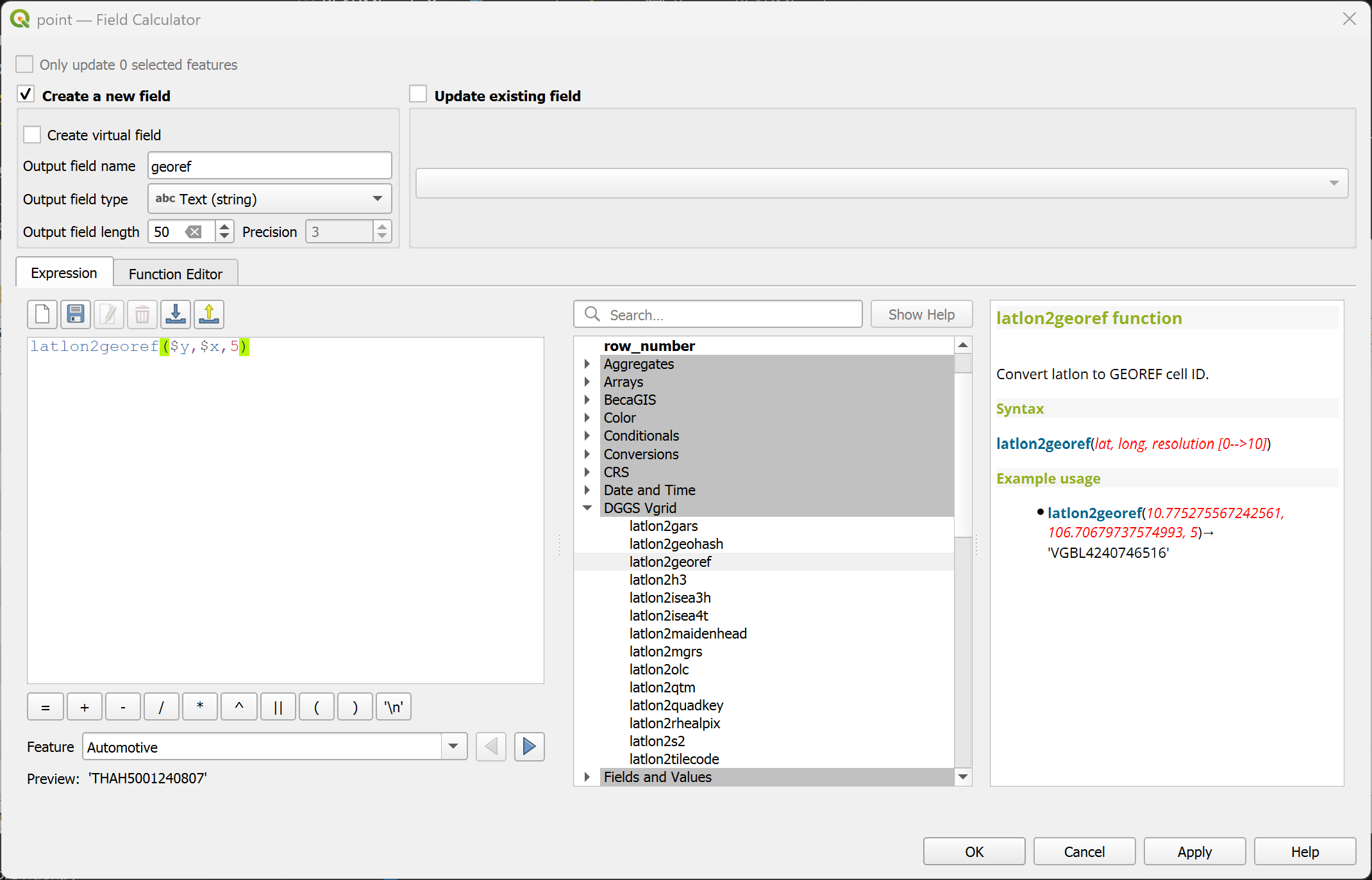
Convert (lat, long) to GEOREF ID.
latlon2georef(lat, long, resolution [0..10]) or latlon2georef($y, $x, resolution) in WGS84 CRS
latlon2georef(10.775275567242561, 106.70679737574993, 5)→ 'VGBL4240746516'
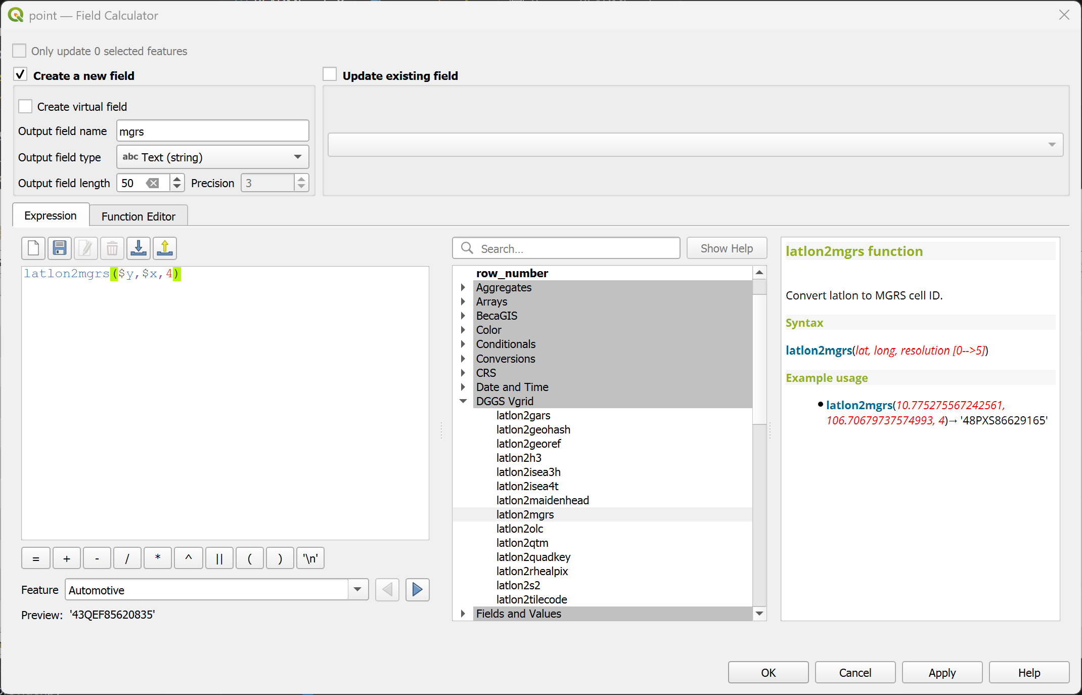
Convert (lat, long) to MGRS ID.
latlon2mgrs(lat, long, resolution [0..5]) or latlon2mgrs($y, $x, resolution) in WGS84 CRS
latlon2mgrs(10.775275567242561, 106.70679737574993, 4)→ '48PXS86629165'
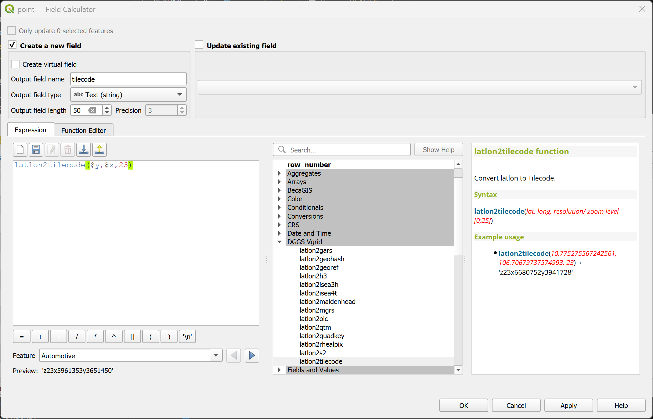
Convert (lat, long) to Tilecode ID.
latlon2tilecode(lat, long, resolution [0..29]) or latlon2tilecode($y, $x, resolution) in WGS84 CRS
latlon2tilecode(10.775275567242561, 106.70679737574993, 23)→ 'z23x6680752y3941728'
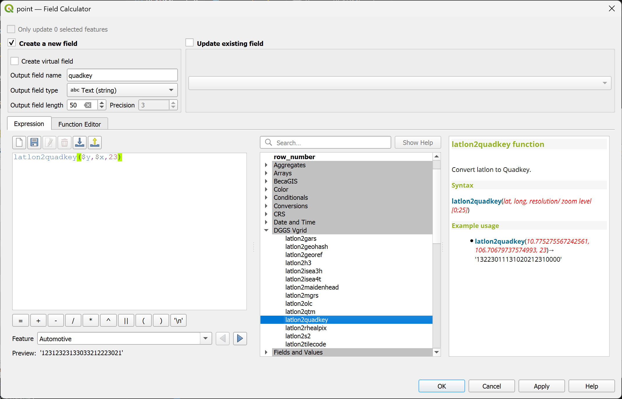
Convert (lat, long) to Quadkey ID.
latlon2quadkey(lat, long, resolution [0..29]) or latlon2quadkey($y, $x, resolution) in WGS84 CRS
latlon2quadkey(10.775275567242561, 106.70679737574993, 23)→ '13223011131020212310000'
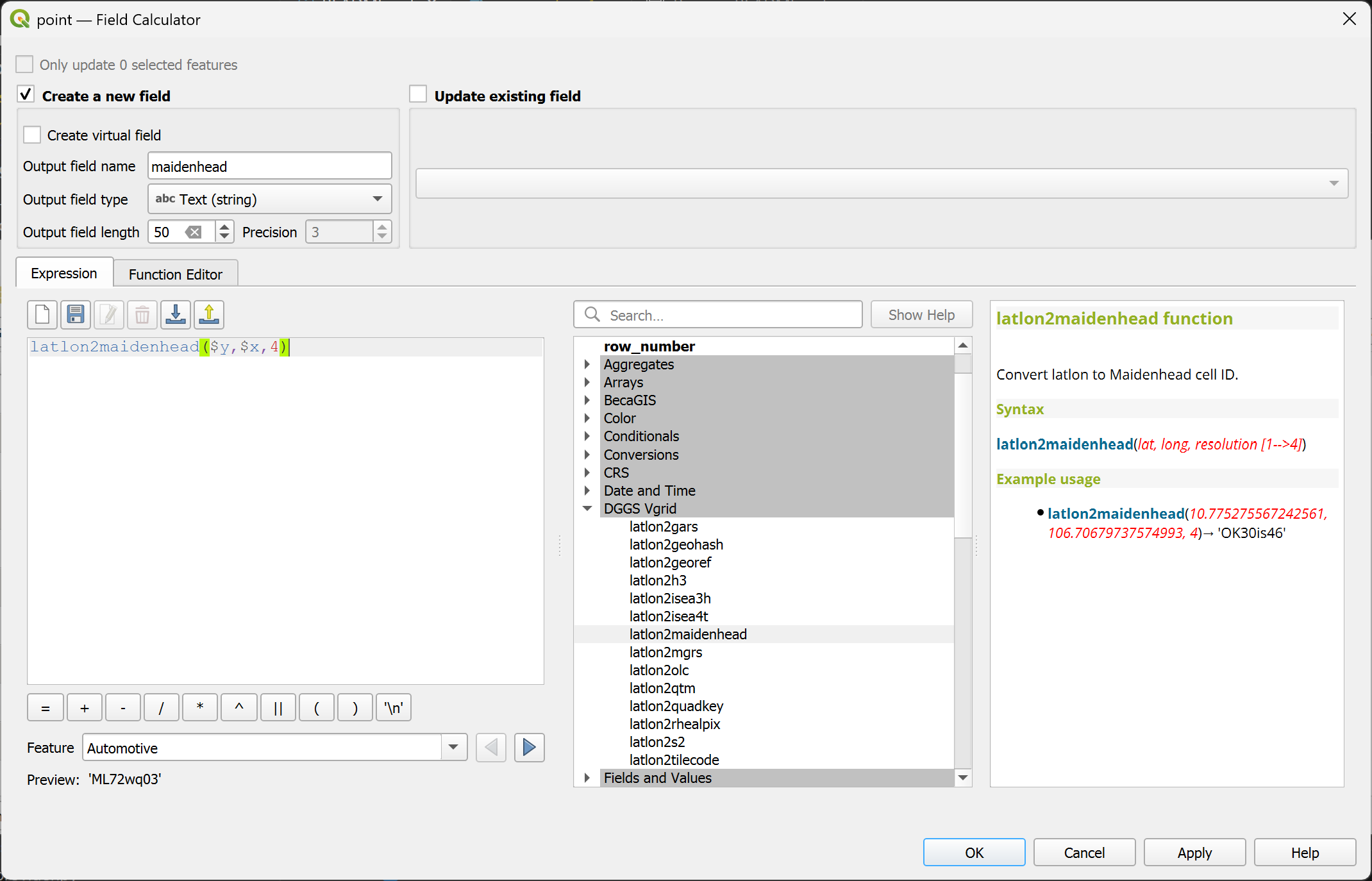
Convert (lat, long) to Maidenhead ID.
latlon2maidenhead(lat, long, resolution [1..4]) or latlon2maidenhead($y, $x, resolution) in WGS84 CRS
latlon2maidenhead(10.775275567242561, 106.70679737574993, 4)→ 'OK30is46'
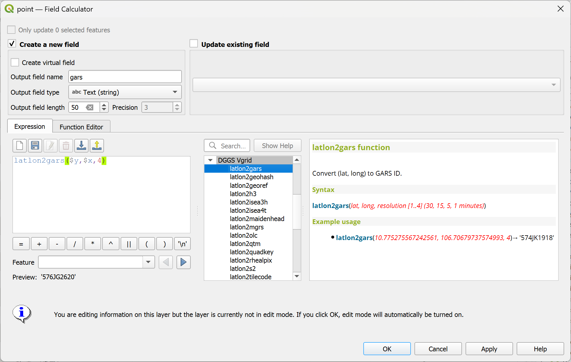
Convert (lat, long) to GARS Code.
latlon2gars(lat, long, resolution [1..4] (30, 15, 5, 1 minutes)) or latlon2gars($y, $x, resolution) in WGS84 CRS
latlon2gars(10.775275567242561, 106.70679737574993, 4)→ '574JK1918'